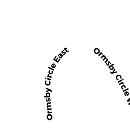
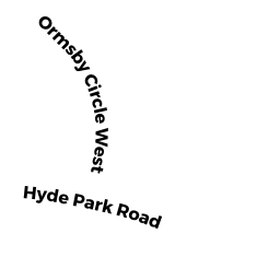
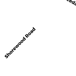
2437 E ORMSBY CIR
JACKSONVILLE, FL 32210
Neighborhood Map


Property Details
This property is classified as Residential (Single Family).
The lot is 12234 square feet, the land value of which is assessed at $95,040.00.
There is one building on the property.
It was built in 1968.
This property is valued at $293,009.00.
The legal description of this lot is: "24-15 42-3S-26E .283".
Sales and Assessment History
| Date | Details |
|---|---|
| 3 / 2016 | $228,000.00 Single Family Book 17484, Page 2320 |
| 2016 Assessment | BROHINSKY ISAAC J changed from |
| 7 / 2015 | $100.00 Single Family Book 17247, Page 327 |
| 7 / 2015 | $70,800.00 Single Family Book 17220, Page 1595 |
| 8 / 2010 | $100.00 Single Family Book 15348, Page 1891 |
| 7 / 2010 | $193,500.00 Single Family Book 15313, Page 2452 |
Flood Data
This property is partially within the AE Zone (within floodplain). Approximately 0.07 acres (18.50%) of the property is within this zone.
The base flood elevation for this flood zone is 4.0 feet.
This information is sourced from the FEMA National Flood Hazard Layer. See our full disclamer.
Registered Voters
Search for "BROHINSKY ISAAC J" in Florida's Voter Registry.
Learn more about Jacksonville through our Voter Demographics page.
Share
Ownership Information
BROHINSKY ISAAC J
2437 E ORMSBY CIR
JACKSONVILLE, FL 32210
Adjacent Properties
- 2447 E ORMSBY CIR (South)
WILLIAMS RICKY P - 2427 E ORMSBY CIR (North)
WOODRUM LARRY R ET AL